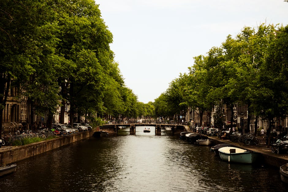
In August 2010, UNESCO inscribed the Amsterdam Canal Ring on the World Heritage List under a precise official name: Seventeenth-Century Canal Ring Area of Amsterdam inside the Singelgracht. The reason: it is the world’s most successfully preserved example of large-scale urban planning from the Renaissance era, a 17th-century engineering and architectural project still functioning as designed 400 years later. This is the complete story of how 30,000 oak piles, 47 years of construction, 1,550 listed buildings and one extraordinarily coordinated city plan became one of the world’s defining cultural heritage sites.
Why is Amsterdam’s canal ring a UNESCO World Heritage Site? Because it’s the best-preserved large-scale city plan from the early modern era still doing its job. UNESCO inscribed it in 2010 as a single coordinated 17th-century scheme that solved housing, defence, drainage and transport at once — and survives almost intact, with more than 1,550 listed buildings standing in their original spots. It isn’t protected for being pretty (though it is); it’s protected as a masterpiece of urban planning that still works 400 years on.
The Canal Ring UNESCO Listing at a Glance
| Question | Short answer |
|---|---|
| Official name | Seventeenth-Century Canal Ring Area of Amsterdam inside the Singelgracht |
| Inscribed | 2010 |
| Built | 1613–1660 (planned from 1610) |
| Area protected | ~650 hectares inside the Singelgracht |
| Main canals | Singel, Herengracht, Keizersgracht, Prinsengracht |
| Listed buildings | ~1,550 historic monuments |
| UNESCO criteria | i (creative genius), ii (interchange of ideas), iv (technological ensemble) |
What UNESCO Actually Protected
The 2010 UNESCO listing covers a specific area: everything inside the Singelgracht — the outermost defensive canal — built between 1613 and 1660. That’s:
- 650 hectares of historic city.
- Four concentric main canals: Singel (the moat), Herengracht, Keizersgracht, Prinsengracht.
- The Jordaan working-class neighbourhood west of Prinsengracht.
- The radial cross-canals (Brouwersgracht, Leliegracht, Leidsegracht, Reguliersgracht, etc.).
- The medieval centre inside Singel.
- 1,550 protected buildings within the inscribed area.
Why the Canal Ring Was Built
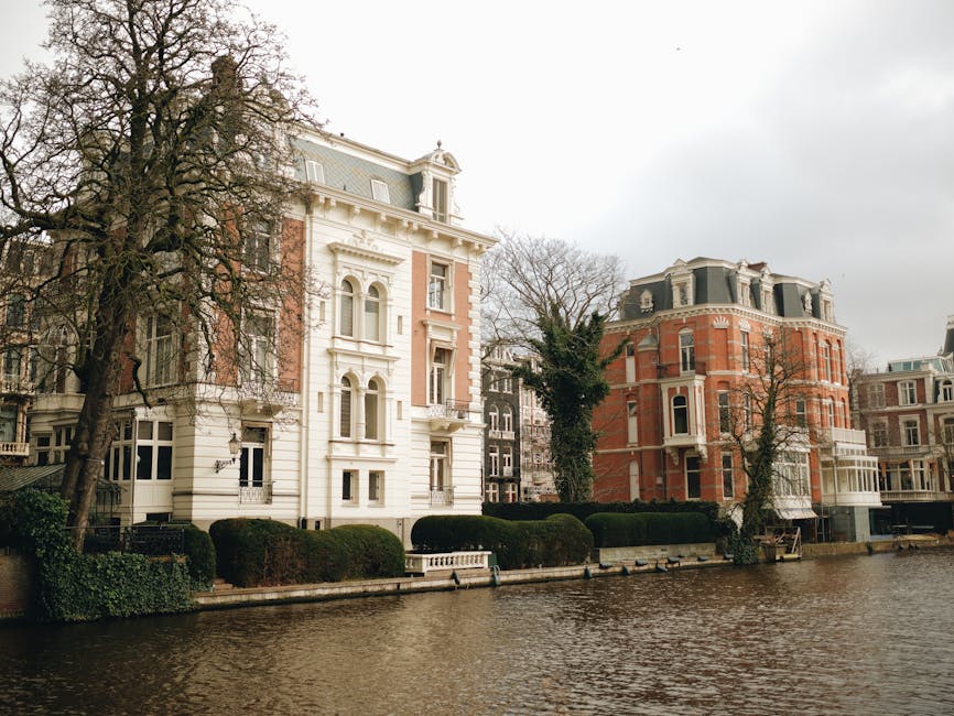
Amsterdam was bursting. Population went from 30,000 in 1570 to 100,000 by 1600 — driven by refugees from the Spanish-occupied southern Netherlands (Fall of Antwerp 1585), the booming spice trade, and the founding of the Dutch East India Company in 1602. The medieval city couldn’t physically contain the influx.
The city council needed a solution that would deliver four things simultaneously:
- Housing for thousands of new merchants and labourers.
- Defence — the outermost canal was a moat with bastions every 200 metres.
- Drainage — the peat-marsh terrain west of the Amstel needed water management.
- Transport — canals doubled as the city’s highways, with goods moving by barge from harbour to warehouse.
In 1610 the master plan was drafted by city architect Hendrik Jacobszoon Staets, with significant contributions from Daniël Stalpaert. The plan: three concentric canals around the existing medieval centre, plus an outer defensive moat. Each ring would serve a distinct social class, with the inner Herengracht for the wealthiest merchants and the outermost Prinsengracht for working trades.
The Construction: 1613–1660
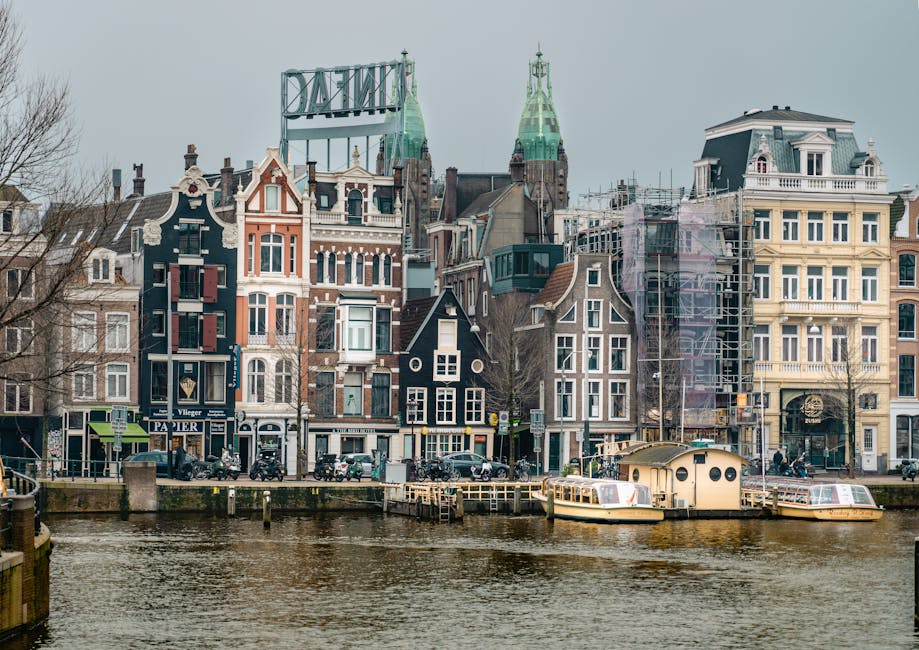
- 1613: construction begins on the northwest section (Brouwersgracht to Leidsegracht).
- 1625: northwest section largely complete.
- 1620s: southwest section started, working clockwise around the city.
- 1656: northeast section reaches the Amstel river. The four main canals are essentially closed.
- 1660s: Jordaan housing fills in west of Prinsengracht.
- 47 years: total construction time.
- 30,000+ oak piles driven into the peat to reach a stable sand layer 12+ metres below.
- Hundreds of thousands of bricks for embankments and house facades.
- The earth excavated from the canals was used to raise the plot levels above water — a single coordinated cut-and-fill operation.
The Genius of the Plan
What makes the canal ring exceptional — and UNESCO-worthy — is the integration of so many functions in one plan:
- Standardised plots: 30 feet wide, 200 feet deep, with regulated maximum house heights to maintain street character.
- Tax-driven architecture: property tax was based on facade width, leading to the famous tall narrow Amsterdam house.
- Embedded warehouses: upper floors of canal houses were grain and goods storage, with hoisting beams on every gable.
- Bridges every 100-200 metres: hundreds of bridges to maintain street connectivity.
- Embankments doubled as roads: foot-and-cart traffic ran alongside boat traffic.
- Defensive bastions on the outer Singelgracht: 26 bastions originally, with cannon batteries.
- Social zoning: clear class hierarchy from Herengracht (richest) to the Jordaan (working class).
- Continuous deep-water transport from the IJ harbour to private warehouses.
It’s worth pausing on how unusual that combination was. Most historic European cities grew by accretion — a street here, a square there, century after century. Amsterdam’s canal belt was the opposite: a single municipal decision to extend the whole city outward in one planned move, financed up front and executed over two generations. The closest modern analogy is a planned new town, except this one was grafted onto a working medieval port without ever shutting it down. Barges kept moving, merchants kept trading, and the new rings filled in behind them. That a 17th-century city council pulled this off — on marshland, with hand tools and wooden piles — is the thing that genuinely impresses once you understand it.
The social engineering was just as deliberate as the hydraulic kind. By zoning the canals — Herengracht for the richest, Keizersgracht for the comfortable, Prinsengracht for working merchants, the Jordaan for labourers and workshops — the city baked a class map into the layout that you can still read today. The grandest stretch, the Golden Bend (Gouden Bocht) on the Herengracht, was where the double-width mansions went up, and property there still carries the same prestige four centuries later. Walk a block outward to the Jordaan and the houses shrink, the streets narrow, and the history shifts from merchant grandeur to working life. The plan didn’t just shape buildings; it shaped who lived where, and a surprising amount of that has stuck.
Why UNESCO Listed It
UNESCO’s official rationale (criteria i, ii, iv):
- Criterion i: "A masterpiece of human creative genius." The canal belt represents the largest and most ambitious urban-planning achievement of the early modern period.
- Criterion ii: "Important interchange of human values." The Amsterdam model influenced urban planning across Europe and beyond — Paris’s boulevards under Haussmann (1850s) borrowed concepts; New York’s grid (1811) used parts of the framework; even modern Singapore drew inspiration.
- Criterion iv: "An outstanding example of a building or technological ensemble." The integration of hydraulic engineering, urban design and architecture is unprecedented in its scale and coherence.
- Authenticity: over 1,550 of the original 17th-century buildings still stand, in their original locations, with original facades.
- Integrity: the canal pattern is fully intact; no canal has been filled in inside the protected area since 1900.
How It Was Preserved
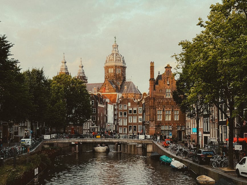
- 1900s: some canal-belt blocks were demolished or filled in (e.g., Vondelstraat extensions) — but the core canal pattern survived.
- 1920s-1950s: parts of the city centre were threatened by car-traffic plans that would have filled multiple canals; protests stopped them.
- 1953: the canal belt is protected as a Dutch national monument zone.
- 1970s: squatter movements and architectural preservation societies blocked demolition plans.
- 1999: Amsterdam officially proposes UNESCO inscription.
- 2010: UNESCO World Heritage inscription. The Singelgracht-inside boundary becomes legally binding.
- Today: any visible alteration to a canal-belt facade requires city heritage approval. Annual inspections.
Engineering Specifics
- Oak piles: 12-metre wood piles driven through the soft peat to reach a stable sand layer. A typical Amsterdam canal house sits on 30-50 piles.
- Cofferdams: the canals were dug after building temporary wooden walls (cofferdams) and pumping out the water.
- Water level: maintained by the Amsterdam Ordinance Datum (NAP), used as the European standard zero.
- Drainage: canal water flows constantly toward the IJ harbour, flushed by the daily tide.
- Bridges: most are 17th-century stone with later cast-iron additions. Several were rebuilt after barge collisions in the 19th century.
- Bell towers on Westerkerk (1631) and Zuiderkerk (1614) were used as visual reference points during construction.
Building on Water: The Problem Nobody Else Had Solved
The single hardest part of the whole project was the ground, because there wasn’t any — not solid ground, anyway. Amsterdam sits on metres of soft peat and clay, the kind of waterlogged soil that swallows anything heavy. The Dutch answer was the timber pile: long oak trunks driven straight down through the muck until they hit a firmer sand layer roughly twelve metres below, then capped and built upon. A modest canal house might stand on thirty to fifty piles; the Royal Palace on Dam Square famously rests on more than thirteen thousand. The piles only last as long as they stay wet and starved of oxygen, which is exactly why the city guards its water table so carefully — let the wood dry out and it rots, and the house above it starts to tilt and sink.
Digging the canals themselves was its own feat. Crews built temporary wooden barriers, pumped out the water, excavated the channel, and used the spoil to raise the building plots above the waterline — a vast cut-and-fill operation done largely by hand and horse. The finished canals then doubled as the city’s drainage and its highway network, flushed toward the IJ harbour by the daily tide so the water kept moving. Four centuries later the same system is still in use, which is the quietly astonishing thing: this wasn’t a monument built to be admired, it was infrastructure built to work, and it has never stopped working. That’s the distinction UNESCO was reaching for when it called the canal ring a “technological ensemble” rather than simply a beautiful old district.
The Houses Themselves
Over 7,000 buildings sit within the UNESCO zone, of which 1,550 are listed as historic monuments. They display every Dutch architectural style from 1600 to 1900:
- Step gables (trapgevel) — 1580-1640.
- Spout gables (tuitgevel) — 17th century; mostly warehouses.
- Neck gables (halsgevel) — 1640-1700.
- Bell gables (klokgevel) — 1660-1790.
- Cornice gables (lijstgevel) — 1700-1850.
- Hoisting beams: every facade has them, even on modern conversions.
- Floor numbering in the Dutch system: ground = begane grond, first floor = 1, etc.
Once you can date a gable, the whole canal ring turns into a timeline you can read at walking pace. A stepped silhouette means early 17th century; an elegant neck or bell shape points to the middle and later decades; a flat cornice with a balustrade is the wealthiest, latest taste. The lean is the other giveaway — many houses tilt slightly toward the street so that goods hoisted on the gable beam clear the windows below, a detail that looks like subsidence but is usually deliberate. None of this is in a museum; it’s just there, on every block, for anyone who knows to look up. For the canals as a living neighbourhood rather than a heritage exhibit — where to eat, which stretches to wander — our Grachtengordel neighbourhood guide is the companion to this one.
The canals are also inseparable from the era that built them. The same trade wealth that paid for the grachtengordel paid for Rembrandt’s commissions and the Rijksmuseum’s future contents — our Dutch Golden Age guide explains where the money came from, and the Amsterdam history timeline places the canal-building decades inside the city’s longer story. If you only do one thing with this knowledge, take a slow evening walk: the light on the water, the gables in silhouette, the bridges lining up — the Reguliersgracht famously shows seven arched bridges in a single view — is the heritage doing exactly what its planners intended.
How to Experience the UNESCO Heritage Today
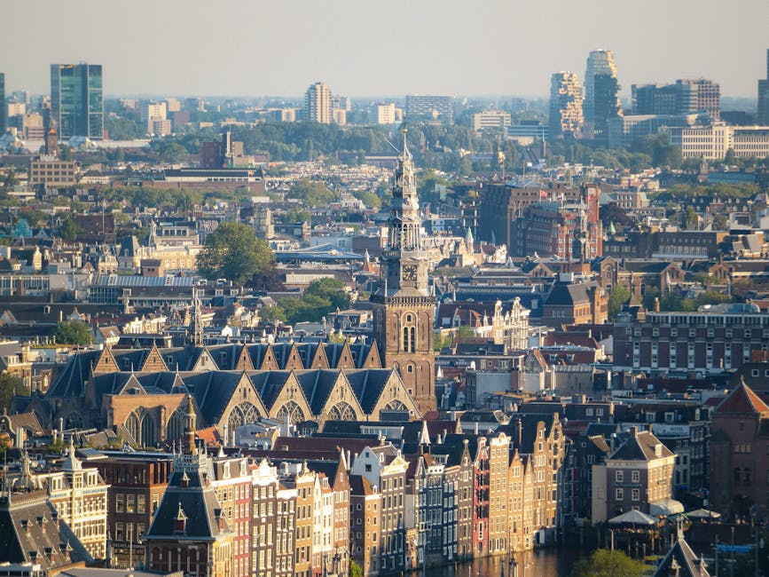
- Het Grachtenhuis Museum (Herengracht 386) — small but excellent museum about the canal-belt construction and history.
- The Bartolotti House (Herengracht 170) — Renaissance facade; one of the most ornate canal houses.
- Bijbels Museum (Herengracht 366-368) — restored 17th-century canal house with original interior.
- Museum Van Loon (Keizersgracht 672) — Patrician family home preserved.
- Willet-Holthuysen Museum (Herengracht 605) — 19th-century canal-house life.
- Felix Meritis (Keizersgracht 324) — 1788 Enlightenment-era science building.
- Hortus Botanicus (Plantage Middenlaan 2A) — 1638 botanical garden inside the UNESCO zone.
- Open Garden Days (June 19-21) — private historic canal-house gardens open to public.
- UNESCO Canal Walk: a self-guided 5-km route published by Amsterdam Heritage.
- A canal cruise gives you the water-level view the original residents had — we compare operators in our canal cruises compared guide.
Other UNESCO Sites in the Netherlands
The Netherlands has 12 UNESCO World Heritage Sites. The Amsterdam canal belt is the most central to tourist Amsterdam, but you can easily combine with:
- Defence Line of Amsterdam — 1880-1920 defensive ring of 42 forts around Amsterdam.
- Mill Network at Kinderdijk-Elshout — 19 working windmills near Rotterdam (for windmills closer to the city, see our day trips from Amsterdam).
- Rietveld Schröder House (Utrecht) — 1924 De Stijl masterpiece.
- Beemster Polder — 1612 reclaimed-land project.
- Schokland and surroundings — former Zuiderzee island.
- Wadden Sea — tidal flats of the North Sea coast.
Seeing It Well: A Few Honest Tips
You don’t need a ticket to experience the most important World Heritage Site in the Netherlands — the canals are free and always open, which is part of the point. That said, a little planning makes a real difference. Go early or late to dodge the densest crowds on the bridges; the Brouwersgracht at the northern edge and the quieter eastern stretches reward anyone willing to walk away from the Anne Frank House queue. One small canal-house museum — Het Grachtenhuis on the Herengracht is the obvious pick — will teach you more about the construction in 45 minutes than an afternoon of guessing. If you want to combine the canals with the wider city, our Amsterdam culture and history hub ties the heritage to the museums and history around it, and the trip planning guide helps you fit it all into a sensible itinerary.
A word on respect: this is a living neighbourhood, not an open-air museum. People live behind those gables, work in those offices and moor their boats along those quays. Keep to the pavements, don’t lean on private doorsteps for photos, and remember that the houseboats are homes. The canals have survived 400 years partly because Amsterdammers fought hard to stop them being filled in for car traffic in the 20th century — treating them as a place rather than a backdrop is the least a visitor can do.
Ongoing Conservation
- Annual maintenance budget for the canal belt is over €60 million.
- Embankment rebuilding projects happen yearly — most canals need stone replaced every 150-200 years.
- Bridge restorations typically take 6-18 months each; the city closes individual bridges in rotation.
- Pile renewal: oak piles last 400-600 years if submerged. Periodically inspected and replaced.
- Threats: tourist over-pressure, short-term Airbnb rentals, climate change (rising water table, heat waves stressing oak).
- UNESCO monitoring: the heritage status comes with periodic review; Amsterdam must report on conservation regularly.
Canal Ring UNESCO: FAQ
When did Amsterdam Canal Ring become UNESCO?
August 2010 — UNESCO inscribed the "Seventeenth-Century Canal Ring Area of Amsterdam inside the Singelgracht."
How old is the Amsterdam Canal Ring?
Construction began in 1613; main canals were complete by 1660. The plan dates from 1610 — over 400 years old.
Why is the Amsterdam Canal Ring a UNESCO site?
For its outstanding example of large-scale urban planning combining defence, drainage, transport and residential development in a single coordinated 17th-century project — and the extraordinary preservation of the original plan and over 1,550 listed buildings.
What does the Singelgracht boundary mean?
The Singelgracht is the outermost defensive canal of 17th-century Amsterdam. The UNESCO inscription covers everything inside this canal — about 650 hectares including the Jordaan and the medieval centre.
How many canals does Amsterdam have?
165 canals, totalling about 100 km. Inside the UNESCO core: the four main concentric canals plus dozens of cross-canals.
Do I need a ticket to see the canal ring?
No — the canals are public streets and free to walk any time. You only pay if you want a canal cruise, a canal-house museum like Het Grachtenhuis or Museum Van Loon, or one of the private garden open days in June. Walking and a short museum visit is the best-value way to understand the UNESCO listing.
What’s the most beautiful stretch of the canal ring?
Opinions differ, but the Brouwersgracht at the northern end is a perennial favourite, and the Golden Bend on the Herengracht has the grandest mansions. For the classic photo, stand on the Reguliersgracht where seven arched bridges line up in a single view. Early morning gives you all three with far fewer people.
Can the houses on the canals be renovated?
Yes, but with permits. Visible facades must be preserved; interior renovations are generally allowed. New build is severely restricted.
Final Thoughts
Walking through Amsterdam’s canal belt is walking through the largest preserved Renaissance-era urban plan on earth. UNESCO didn’t list the canals because they’re pretty — they listed them because they represent the most successful integration of engineering, urban design and social planning produced anywhere in 17th-century Europe, still functioning as designed 400 years later. Understanding that helps every cobble and gable make more sense.
For more, see our Amsterdam Canal Ring (Grachtengordel) Guide, our Amsterdam History Timeline, and our Dutch Golden Age.
Keep exploring
- Amsterdam culture & history — the hub for museums, heritage and the Golden Age.
- Grachtengordel neighbourhood guide — the canals as a place to wander and stay.
- Dutch Golden Age — the era that paid for the canals.
- Canal cruises compared — the water-level view, operator by operator.
- Architecture walking guide — gables, canal houses and modern Noord on foot.